Closing the Gap Feasibility Study
The Southeast Regional Planning and Economic Development District (SRPEDD) helped the South Coast Bikeway Alliance learn more about the options for creating the South Coast Bikeway through Westport, Dartmouth, and New Bedford. The result was the Closing the Gap Feasibility study. The study is briefly mentioned on SRPEDD’s Active Transportation page.
Massachusetts Bicycle Transportation Plan 2019
The Bicycle Transportation Plan and its companion document, the Municipal Resource Guide for Bikeability, represent MassDOT’s continued commitment to multimodalism, to investing in infrastructure that supports biking and walking and transit, and to partnering with municipalities to build complete streets.
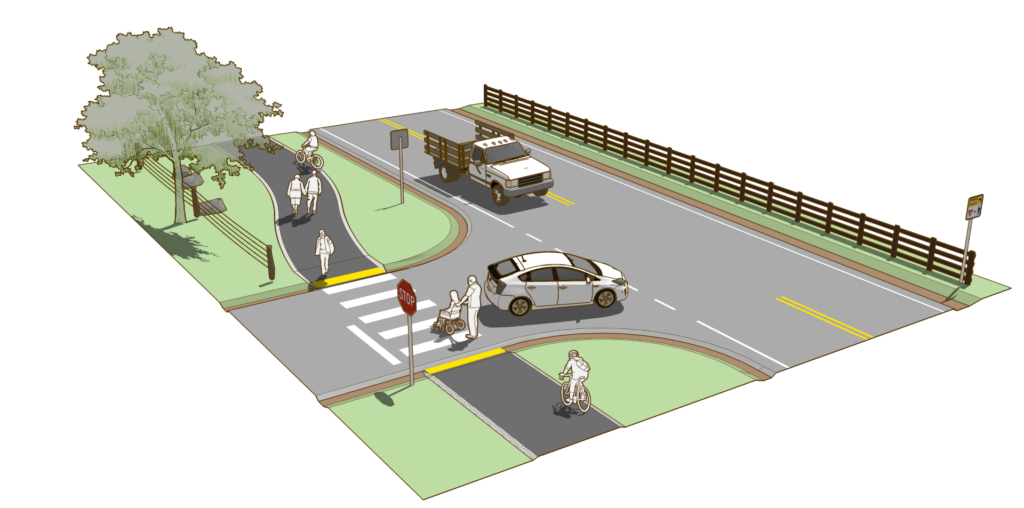
Complete Streets
Complete Streets are roadways that safely and comfortably accommodate all users, regardless of age and ability or mode of transportation. Users include, but are not limited to: motorists, bicyclists, pedestrians, public transportation riders and providers, emergency response vehicles, and school buses.
Safe Routes to School
SRTS is a free, federally funded program administered by the Massachusetts Department of Transportation that works to increase safe walking, biking, and rolling among public elementary, middle, and high school students. They use a collaborative, community-focused approach that bridges the gap between health and transportation.
You can find out if your city or town is in the Safe Routes to School program by visiting the resource page on the SRTS website. The SCBA is a Safe Routes to School Alliance Partner. Read the SRTS Program Guide.
Massachusetts Planning & Design Guide
https://www.mass.gov/manual/massdot-project-development-and-design-guide