Team South Coast Bikeway hit the road again. You can read more about it here.
news
Moving Forward – A Recap of 2024 and a Look Ahead
The South Coast Bikeway Alliance (SCBA) marks another year of progress towards completing the bikeway and securing a safe, inclusive environment for cyclists and pedestrians. Please read all about it in our newsletter.
Pedal for the Path 2024
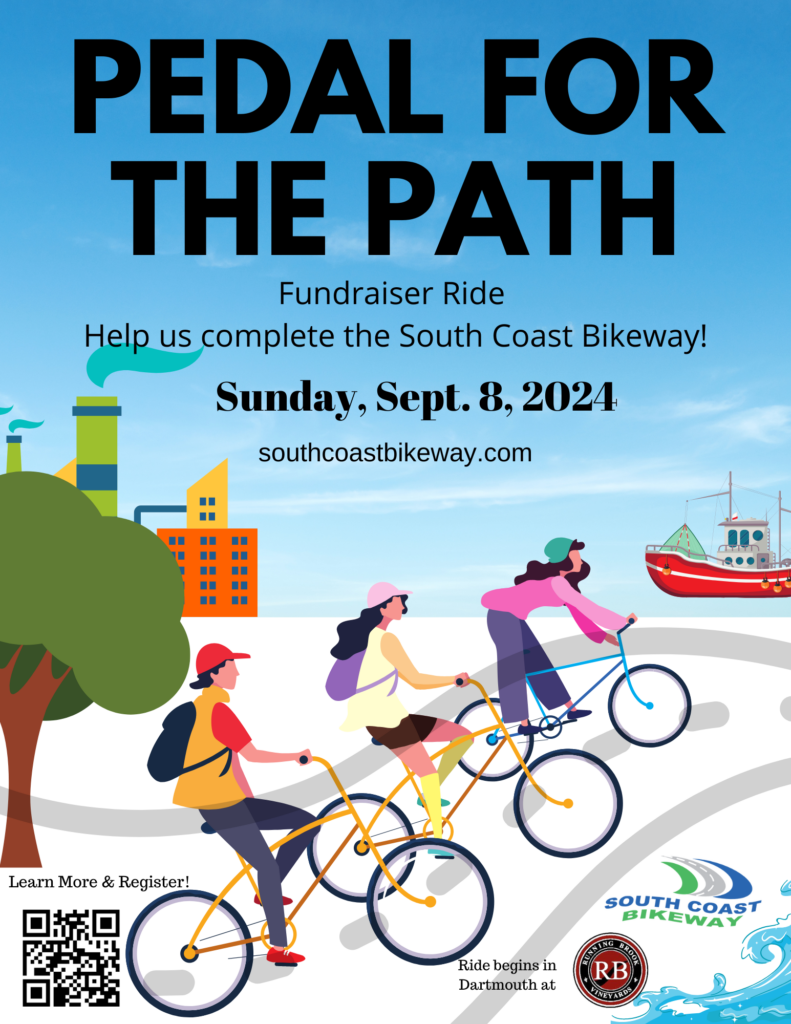
Join us for our signature event of the year – a cycling tour of the South Coast with beautiful views, quiet roads and lots of fun.
New this year: the 35-mile loop will follow the newly established Dartmouth Heritage Trail bicycle route, winding through Dartmouth’s ten founding villages from Hixville in the north to Round Hill in the south. The official PFTP route will be posted on our website and Facebook event and emailed closer to the ride. A waiver will be provided at sign-in.
Also new this year: registration is free. You can donate here. There are two new ways to show your support. Jerseys and Tech tees are available for purchase at registration.
This signature event highlights the beauty and history of the South Coast and includes ice cream! We will celebrate recent progress along the South Coast Bikeway, highlight the Northern Scenic Greenway project that will connect Fall River to New Bedford through Westport and Dartmouth, and update attendees about the status of the bikeway in our ten-member communities.
New this year, it’s FREE, but let us know you are riding.
Donations are welcome and Merch is for sale.
Online registration closes at 6 p.m. on Saturday, 9/7. Event-day registration is welcome at 8 a.m on 9/8. The ride starts at 9 a.m.
What is it?
The South Coast Bikeway Alliance (SCBA) will hold its sixth regional bike ride, Pedal for the Path. Beginning and ending at Running Brook Vineyard, 35-miles of fabulous cycling, postcard-perfect scenic views, more historic places than you can count, and, along the way, memorable ice cream and more! A post ride celebration features a food truck, wine and beverages for purchase, and live music.
Sponsored stops include:

Davoll’s General Store rest stop
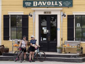
Scuttlebutt Coffee Company Water Stop

More to come...
ROUTE
Official SCBA PFTP 35 mile Route: Ride with GPS route
Use the RidewithGPS app (iOS or Android), or visit the links above to download route data or send to your device.
Please check back here and on our Facebook page for the latest event updates. Contact us at thesouthcoastbikeway@gmail.com if you have any questions.
We need to know how many will attend, sign up – right away!
Not planning to ride? Donate Thank you!
We will need plenty of help on the day of the event, Sunday, September 8. If you don’t feel like riding but want to be outside doing something helpful and fun – then this is your opportunity to have it all.
What is it for?
This ride will help raise funds to further advance the results of the Closing the Gap feasibility study enabling the communities of Dartmouth, New Bedford, and Westport to move closer to completing their portions of a multi-use South Coast Bikeway spanning from Swansea to Wareham. Sections have already been completed in Fall River, Fairhaven, New Bedford and Mattapoisett. We need your help to bring the Path to completion!
FAQ’s
What are my transportation/parking options for getting to and from the event?
- There’s plenty of free parking at Running Brook Vineyard, 335 Old Fall River Rd, Dartmouth, MA 02747 from 8 am to 4 pm. Look for the event sign.
When can I check in for the ride?
- Registration check-in starts at 8:00 am. All riders must check-in. The ride starts at 9 am. Riders must return by 3:00 pm; ride support will be provided up to 3:00 pm.
How can I contact the organizer with any questions?
- Email us: thesouthcoastbikeway@gmail.com
What’s the refund policy?
- This is a free event. And the ride will be RAIN or SHINE.
Do I have to bring my printed ticket to the event?
- Registration is required but tickets are not.
- You will be required to sign a waiver when you arrive.
What is the terrain?
- The route traverses country roads as well as city streets and a few suburban blocks. A drawbridge, that opens every half hour, may encourage you to pause and look at the boats! Water refills and bathrooms will be available at rest areas and ice cream stops.
How do I get my ice cream or other benefits?
- Present yourself at the counter or kiosk with your rider bib on.
What kind of cycling support will be available?
- Yesteryear Cyclery will offer pre-ride safety checks and on-road assistance.
- On the Spot Mobile Bike Repair will provide assistance at the start, on the road as needed, and will sweep the course.
- Artemis Cyclery will provide assistance at the start, on the road as needed, and will sweep the course.
What if I can’t complete the entire route?
- You will be provided a phone number for assistance.
- In an emergency, call 911.
What about maps/cue sheets?
- 35 mile route: GPS route to be provided
- Printed maps and cue sheets will be available for viewing at check-in on the day of the ride.
What do I need to bring on the day of the ride?
- Remember to register online. We will have a list of registered riders.
- Helmets must be worn.
- Water bottles are a must for this long ride. Water stations will provide refills.
- Bike gloves help prevent injury to hands from long hours on the handlebars.
- If you desire food along the way, be prepared to purchase items at stores along the route.
Thank you to our 2024 Sponsors!




Rider support generously provided by:


TAKE THE SURVEY!
SRPEDD is a regional planning agency helping 27 cities and towns in Southeastern Massachusetts plan for transportation, environmental, housing, economic development, homeland security, and quality of life improvements. SRPEDD staff are updating the Southeastern Massachusetts Regional Pedestrian Plan this year. Your responses to this survey will help:
- Establish a collective vision for walkability in Southeastern Massachusetts,
- Identify the current challenges pedestrians experience using the region’s roadway, sidewalk, crosswalk, path, and trail networks, and
- Determine which walkability improvements are most important to residents in the region.
Your survey responses are completely confidential and will not be connected to you personally. This survey should take no longer than 5 minutes to complete depending on the detail of your responses. Take the Survey!
SCBA Annual Meeting
Greetings South Coast Bikeway Alliance followers. Have you provided your contact information to our organization at one of our past meetings, at an event such as our annual Bike Summit or Pedal for the Path fundraiser, etc?
Anyone who has done so is considered a “member” of the alliance and, therefore, eligible to vote for the Steering Committee Members and officers at the Annual Meeting of the South Coast Bikeway Alliance. Won’t you please consider volunteering your time and talent to help us complete the South Coast Bikeway? Not a cyclist? No worries! Pathways are for all who walk, run, ride and roll.
The 2024 Annual Meeting will be held on Tuesday, April 9, at 6:00 pm at the James Arnold Mansion (formerly known as the Wamsutta Club) at 427 County St. in New Bedford. Access via zoom will be provided.
Nominations will be accepted for the following officer positions, in writing, up until Thursday, April 4, at 6:00 pm. by completing this form https://forms.gle/Rg46hLMutiP2Kc1E7
or sending them to thesouthcoastbikeway@gmail.com.
Officers
President
Vice President
Secretary
Treasurer
Steering Committee Member – Wareham, Marion, Mattapoisett, Fairhaven, New Bedford, Dartmouth, Westport, Fall River, Somerset and Swansea
For more detail on the role and responsibility of each position, please refer to the SCBA bylaws which may be found at https://southcoastbikeway.com/resources/bylaws/.
If you have any questions, please send them to thesouthcoastbikeway@gmail.com.
Marion Shared Use Path Construction (Phase 1) Open House Public Meeting
Shared Use Path Construction (Phase 1)
Open House Public Meeting
Event Date: Wednesday, January 31, 2024 – 6:00pm
Marion Music Hall
164 Front Street, Marion, MA 02738 See map: Google Maps
The Massachusetts Department of Transportation and Town of Marion are announcing that an Open House Public Meeting about the Shared Use Path (Phase I) project’s Expanded Environmental Notification Form (EENF) will take place on Wednesday, January 31 at 6 pm at the Marion Music Hall.
The open house will be hosted to provide the public with additional details about the project and answer questions about the Massachusetts Environmental Policy Act (MEPA) Office review process for the Shared Use Path (SUP). At the Open House, project managers, town officials, and consultants will share details regarding the Massachusetts Environmental Policy Act process for project review and information about the upcoming submittal of the project’s Expanded Environmental Notification Form (EENF).
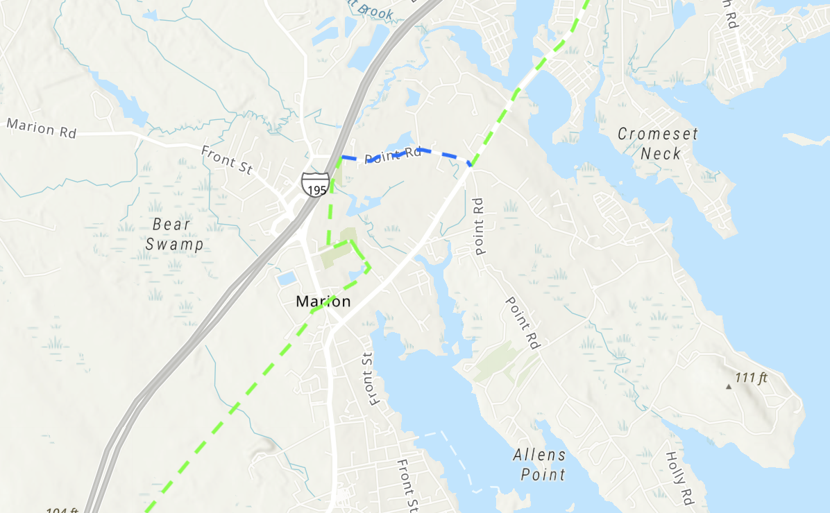
The Marion SUP project consists of the construction of a shared use path in the Town of Marion from the Mattapoisett/Marion Town line to Point Road, including a path crossing and intersection improvements at the Route 105/Spring Street intersection and a paved recreational path through Washburn Lane. The proposed shared use path extends from the Marion/Mattapoisett town line near Industrial Road and ends at Point Road in Marion, adjacent to Interstate 195. The Massachusetts Department of Transportation – Highway Division (MassDOT) is proposing construction on behalf of the Town, which includes intersection improvements proposed at the Route 105/Spring Street crossing to accommodate pedestrian, bicycle, and vehicular traffic. The total length of the project is approximately 3.8 miles. The project is located entirely within Marion’s borders.
The SUP will continue the development of the South Coast Bikeway, a 50-mile continuous system of SUPs connecting Rhode Island to Cape Cod, giving the Marion community increased connectedness to open space and recreation while simultaneously reducing the need for vehicle use. The SUP will provide an overall benefit to the town of Marion with a readily available resource for exercise and enjoyment that can be enjoyed by both local Environmental Justice and non-Environmental justice communities.
The project is currently at 100% design as of December and has provided advanced notice in January about the pending submission of its EENF form to MEPA.
