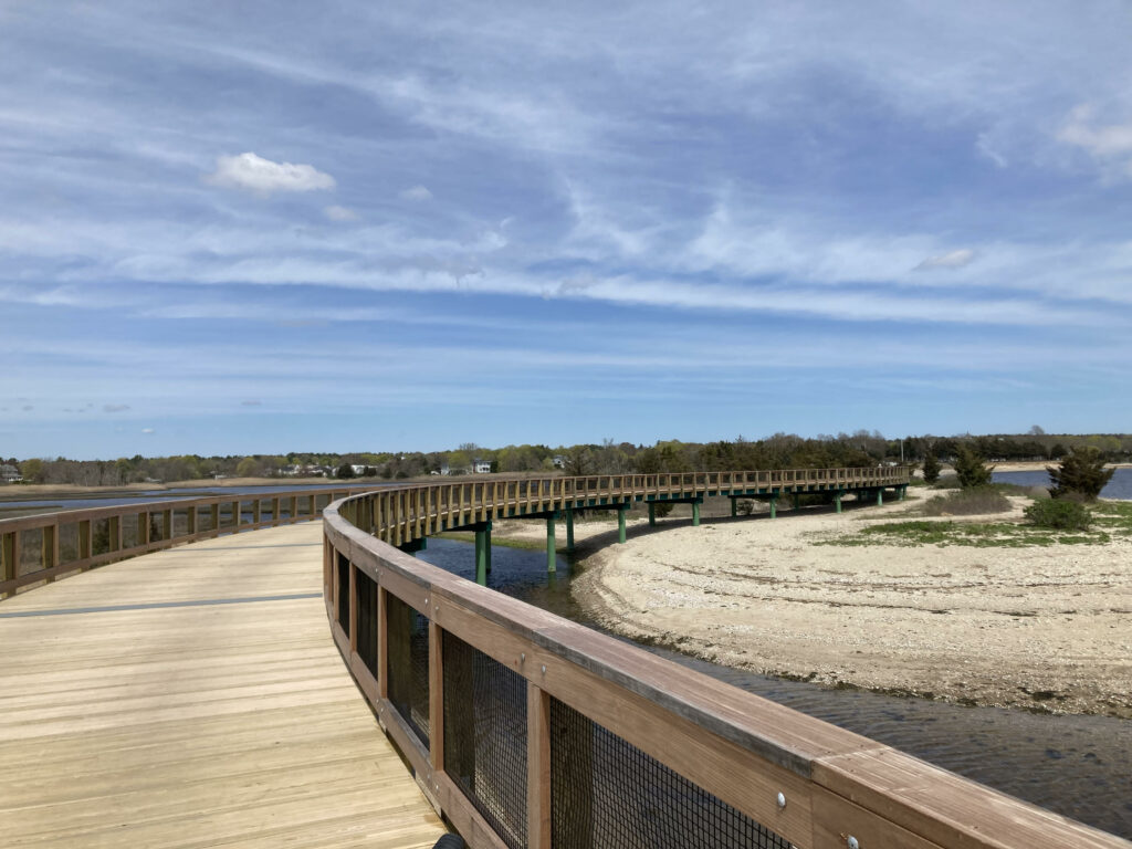
The pathway will be on the abandoned railroad bed in the woods parallel to I-195 from the Mattapoisett Town line to Front Street in Marion. We are looking forward to the anticipated start of construction in early 2023.
News
Funding for next phase of Quequechan River Rail Trail
Funding for next phase of Rail Trail
According to the Fall River Herald …the latest list of new ARPA projects reviewed by Coogan’s ARPA Task Force includes $4 million to complete phase 4 of the Quequechan Rail Trail project.
According to a website by the trail’s landscape architects, phase 4 will connect the existing rail trail to the recently renovated Father Travassos Park. The design for phase 4 is complete and the project has been awaiting funding to move ahead.
Pedal for the Path 2021
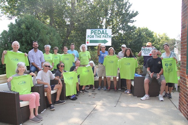
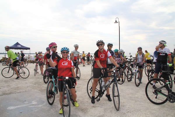
Cyclists Support South Coast Bikeway at Pedal for the Path
https://coastlinenb.org/wp-content/uploads/2021/10/SeniorScope_Oct2021.pdf
Pedal for the Path 2020
If you couldn’t join us on Sunday the 13th, ride the route (details below) any time during Bike Month (September). Be sure to send a photo to thesouthcoastbikeway@gmail.com or Facebook. We will share the photos on Facebook. There is still time to Cycle and Celebrate September!
On Sunday, September 13, 2020 from 9 am to 3 pm
South Coast Bikeway Alliance members will be celebrating Bay State Bike Month and the South Coast Bikeway with our third annual Pedal for the Path ride by bicycling from Horseneck Beach State Reservation in Westport, through Dartmouth, New Bedford, Fairhaven and Mattapoisett before returning back to the start. Please join us! Ride the whole route or select a portion. The choice is yours. Just join us to show your support. Alliance representatives will be located along the route in each community to welcome you and share the news of the bikeway in their city or town.
We have a lot to celebrate!
We were recently awarded grants from MassTrails and BayCoast Bank to complete Phase 2 of a Feasibility Study to determine the best way to connect Fall River and New Bedford with pathways through Westport and Dartmouth.
Your input is needed!
Southeastern Regional Planning and Economic Development District (SRPEDD) has been implementing Phase 1 of the Feasibility Study. SRPEDD staff will be on hand during the ride to share preliminary findings and seek your feedback. You can also participate online. Visit: https://scba-feasibility-study-srpedd.hub.arcgis.com/ and share your thoughts and comments.
The ride details!
This will be a socially distanced casual ride with no registration fee.
- Masks are required when we gather at stops and can’t maintain six feet of separation.
- Helmets are mandatory.
- Bring water and snacks.
We will NOT be able to offer ride support, traffic controls, or pre- and post-gatherings.
Instead, we encourage people to ride on their own, with the opportunity to meet SCBA representatives at key intersections. We have lots of news to share!
Please register, at https://www.facebook.com/events/846773802519550/ so we know how many to look for.
As always, you can donate here: https://www.facebook.com/southcoastbikeway/ or mail a check to South Coast Bikeway Alliance ℅ SRPEDD, 88 Broadway, Taunton, MA 02870.
All donations will be used as matching funds in our efforts toward designing and building the SouthCoast Bikeway. We have been successful getting grants, but funders expect us to provide matching funds. Your support is greatly appreciated.
If you can’t join us on Sunday the 13th, ride the route any time during Bike Month (September). Be sure to send a photo to thesouthcoastbikeway@gmail.com or Facebook. We will share the photos on Facebook.
The route: https://ridewithgps.com/routes/33707375
PICK YOUR STARTING POINT, DISTANCE, ONE-WAY OR ROUND-TRIP – YOUR CHOICE.
Distances are noted: One-way (Round-Trip)
Westport Horseneck Beach Reservation to Mattapoisett : 26.8 (53.6 RT) miles
- Starting at 9 am.
- Westport and Swansea Representatives, Fall River Mass in Motion will be on site from 8 am.
Additional starting points and distances:
Dartmouth YMCA to Mattapoisett: 16.8 (33.6 RT) miles
- Starting at 10:30 am
- SRPEDD and Dartmouth Representatives will be on site from 9:30 am.
New Bedford Pier 3 to Mattapoisett: 6.8 (13.4 RT) miles
- Starting at 12:00 pm
- New Bedford Representatives will be on site from 11:00 am
Fairhaven Phoenix Rail Trail to Mattapoisett: 4 (8 RT) miles
- Starting at 12:30 pm Phoenix Rail Trail at Main ST.
- Fairhaven Representatives will be on site from 11:30 am. Look for them on the Phoenix Rail Trail at Main ST and South ST.
Mattapoisett – At (current) end of Mattapoisett Rail Trail at Mattapoisett Neck RD.
- Mattapoisett Representatives will be on site from 11:30 am to share the latest news of the progress of the Shining Tide portion of the Mattapoisett Rail Trail. Marion and Wareham Representatives will be on site from 11:30 am on the Mattapoisett Rail Trail at Mattapoisett Neck RD.
Return: Route in reverse – Mattapoisett to Westport or your original starting point.
- Starting at approximately 1:30 pm to return
Start times are approximate. SCBA reps will be on hand one hour prior to the start times.
Have Fun, Be Safe, and Thank You for your support!
Pedal for the Path – 2019
Dear Readers,
The South Coast Bikeway Alliance would like to thank the 73 riders, 40+ volunteers and many supporters of our second annual Pedal for the Path fundraiser bike ride, held on Sunday, August 18, 2019. The ride was established to raise funds for the completion of the South Coast Bikeway, specifically the missing connection between New Bedford and Fall River.
The South Coast Bikeway, once realized, will be a 50-mile continuous system of bike paths (or multi-use paths) and bike lanes that will connect Rhode Island to Cape Cod. Cities and towns included in this plan are Swansea, Somerset, Fall River, Westport, Dartmouth, New Bedford, Fairhaven, Mattapoisett, Marion and Wareham. Several segments of the bikeway already exist in Swansea, Fall River, New Bedford, Fairhaven, Mattapoisett and Wareham.
We would like to thank our host venue, Dartmouth YMCA, our ice cream sponsors: Annie’s Ice Cream Shack, Acushnet Creamery (Pier 3 New Bedford and Dockside in Padanaram),and Alderbrook Farm and Head Town Landing Country Store for providing donuts for all of our riders. A special thank you to Kim Camara of Yesteryear Cyclery for providing support for the bicyclists before and along the route. Thank you to the Chase Farm Veterinary Hospital, Pare Corporation, Dartmouth Rotary and The Black Whale/Not Your Average Joe’s for their generous sponsorship. Thank you also to Moby Dick Brewery, Native Water, B4 Printing, Shaw’s Dartmouth, Stop & Shop Dartmouth and the United Way of Greater New Bedford for their support.
The South Coast Bikeway Alliance is working to connect our communities with improved bicycle and pedestrian accommodations. For more information about our organization and how you might get involved please visit southcoastbikeway.com.
With gratitude,
The South Coast Bikeway Alliance
What is it?
The South Coast Bikeway Alliance (SCBA) will hold its second regional bike-ride fundraiser, Pedal for the Path.
Beginning and ending at the Dartmouth YMCA, three distances (57, 20 and 12) offer miles of fabulous cycling, postcard perfect scenic views, more historic places than you can count, and, along the way, memorable ice cream and a donut! A post ride celebration features food and Moby Dick Brewing Co. beer for purchase!
Sponsored stops include: (Note: Each route has a different selection of stops.)
Acushnet Creamery at Pier 3 – ice cream
Annie’s Ice Cream Shack – ice cream
The Black Whale – water stop
Head Town Landing Country Store – donuts
Alderbrook Farm – ice cream
Dockside Ice Cream – Acushnet Creamery
A map and complete details will be available soon.
57 mile route: https://ridewithgps.com/routes/30758266
20 mile route:https://ridewithgps.com/routes/30795872?privacy_code=NoR2hPgiKtf6Q5dT
12 mile route: https://ridewithgps.com/routes/30795677?privacy_code=f2swvhgC02Lz7QGy
Please refer to our Facebook page for the latest event updates. Contact us at thesouthcoastbikeway@gmail.com if you have any questions.
Registration opens July 7th. As space is limited, sign up – right away! https://pedal-for-the-path-2019.eventbrite.com
Not planning to ride? Donate anyway on our website or Facebook page! Thank you!
Volunteers Needed!
We will need plenty of help on the day of the event, Sunday 18 August. If you don’t feel like riding but want to be outside doing something helpful and fun – then this is your opportunity to have it all. Click on the button above to sign up.
What is it for?
This ride will help raise funds for an engineering feasibility study enabling the communities of Dartmouth, New Bedford, and Westport to move closer to completing their portions of a multi-use South Coast Bikeway spanning from Swansea to Wareham. Sections have already been completed in Fall River, Fairhaven, New Bedford and Mattapoisett. We need your help to bring the Path to completion!
FAQs
What are my transportation/parking options for getting to and from the event?
- There’s plenty of parking in the YMCA parking lot. The Dartmouth YMCA is located at 276 Gulf RD, South Dartmouth, MA 02748.
When can I check in for the ride?
- Registration check-in starts at 8:00 am. All riders must check-in at planned intervals (indicated on map and cue sheet). Riders must return by 3:00 pm; ride support will be provided up to 3:00 pm.
How can I contact the organizer with any questions?
- Email us: thesouthcoastbikeway@gmail.com
What’s the refund policy?
- No refunds, very sorry. And the ride will be RAIN or SHINE.
Do I have to bring my printed ticket to the event?
- Print or online receipts are accepted.
- You will be required to sign a waiver when you arrive.
Is my registration fee or ticket transferable?
- Not transferable, sorry.
What is the terrain?
- The route traverses country roads as well as city streets and a few suburban blocks, depending upon the distance you choose. Two draw bridges, that open every half hour, may encourage you to pause and look at the boats! Water refills and bathrooms will be available at rest areas and ice cream stops.
How do I get my ice cream or donut?
- Present yourself at the counter with your rider bib on. The 57 mile and 20 mile routes include a donut stop!
What kind of cycling support will be available?
- Yesteryear Cyclery will provide assistance at the start, on the road as needed, and will sweep the course.
What if I can’t complete the entire route?
- You will be provided an emergency phone number for assistance.
What about maps/cue sheets?
- 57 mile route: https://ridewithgps.com/routes/30758266
- 20 mile route: https://ridewithgps.com/routes/30795872?privacy_code=NoR2hPgiKtf6Q5dT
- 12 mile route: https://ridewithgps.com/routes/30795677?privacy_code=f2swvhgC02Lz7QGy
- Maps and cue sheets will NOT be available through Eventbrite.
- Printed maps and cue sheets will also be available at check-in on the day of the ride.
What do I need to bring on the day of the ride?
- Remember to bring your confirmation email (electronic or hard copy) with you to check-in.
- Helmets must be worn.
- Water bottles are a must for this long ride. Water bottles will be given at check-in. Water stations will provide refills.
- Bike gloves help prevent injury to hands from long hours on the handlebars.
- Snacks and water are provided at the checkpoints. If you have other preferences (sports drink, juice, etc.) be prepared to purchase items at stores along the way.
Trail Building Workshop #4: Map & Compass
Thank you to all who participated in our Map & Compass Workshop taught by Paul Brookes. It was a beautiful day to learn orienteering skills at the Dartmouth Natural Resources Trust (DNRT) Center at Helfand Farm. This workshop was funded through an educational grant from the Massachusetts Department of Conservation and Recreation. Thank you to Stop & Shop Dartmouth for providing refreshments for the participants.
Map & Compass – Workshop #4
The South Coast Bikeway Alliance (SCBA) is recruiting participants for a Map & Compass Workshop, funded by the Massachusetts Department of Recreational Trail Building Grant program. The free workshop, held on Saturday, December 29, 2018, from 9-4, will be taught by Paul Brookes.
Paul Brookes has been a hike leader for the Southeastern Massachusetts chapter of the Appalachian Mountain Club (AMC) for 6 years. He leads numerous three-season hikes as well as an annual winter hiking series out of the Blue Hills. He recently taught a Map and Compass course for the AMC. Paul is experienced in experiential and classroom teaching. He is faculty for Daniel Webster College in Nashua NH, teaching evening engineering courses.
The SCBA asks those who attend for these free workshops to pledge one hour of service on the South Coast Scenic Greenway or other SCBA project in exchange for each hour of classroom hour attended.
Course objectives
In this course you will learn basic and intermediate navigation skills using a map and compass. You’ll learn how to read a topographic map and how to use a compass and map together. You’ll also learn some basic orienteering skills such as how to bushwhack from one trail to another by following a bearing.
Prerequisites
This class is for beginners and those needing a refresh, there are no prerequisites. You do not need to have taken any prior classes or have any prior experience reading a topographic map or using a compass.
Course Outcomes
After completing this course, you should be able to use a topographic map (even without a compass) to provide assurance after an intersection that you’re on the right trail and not a deer path or bootleg bicycle path.
You should be able to use a compass in tandem with your map to safely leave the trail and bushwhack to a peak or overlook. You should also be able to leave a trail, bushwhack to another trail and not miss it or get lost.
The material is broken down into small segments that build on top of each other and no prior experience necessary. We’ll often break into small groups to practice the skills taught. Some exercises will be in the classroom and others will be in the field outside. Facilitators will be on-hand to help lead the small-group exercises.
We will finish the day with a short hike where you will get to put into practice many of the skills you learned during the day including a bushwhack to an intersection or landmark.
The Details
Date: Saturday, December 29, 2018 (Rain or shine)
Time: 9 am to 4 pm
Where: Dartmouth Natural Resources Trust (DNRT) Center at Helfand Farm
318 Chase Road, Dartmouth MA 02747
Lunch will be provided.
Supplies needed: You will need to bring your own compass. The instructor recommends the Suunto M-3 which he will be using during the class.
Click on the link below to be considered for participation. Space is limited.